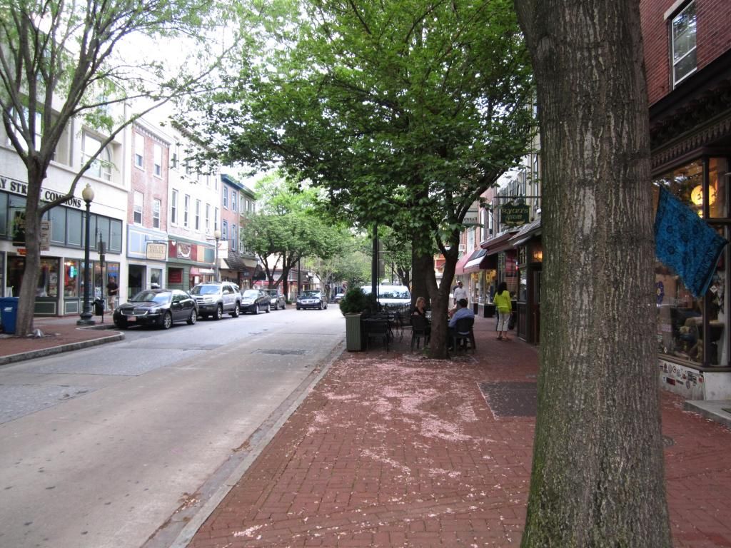
In a Pittsburgh Business Times article, Greensburg, a large suburb east of Pittsburgh, will attempt to build its economy around its current education and medical institutions. Like Pittsburgh, Greensburg's economy was based almost entirely on manufacturing. When the steel industry collapsed in the 1970s, it sent a ripple effect through the entire region; jobs left and the population began to dwindle. Now with the region showing some growth for the first time in decades, Greensburg will attempt to capitalize on some of the driving factors stimulating this growth.
The article referenced the relocation of UPMC's Children's Hospital to Lawrenceville stimulating growth in that neighborhood. The fact is that Lawrenceville was growing even before the hospital moved there. The Strip District has been experiencing growth and redevelopment for years, and it eventually spilled over into Lawrenceville. Both of these neighborhoods were primarily commercial and industrial centers, but have since given way to residential and mixed use development.
Given that, it would be wise for Greensburg to follow suit with this. The city should not focus solely on bolstering its campus of educational and medical institutions, but they should consider redevelopment and revitalization of some parts of the city through mixed use and residential development. I know there is some talk taking place about bringing a commuter rail line to Greensburg. Even though the heavy freight traffic would make such a venture almost impossible, I think this should be pursued. The train station could be transformed into an intermodal facility, bolstering demand for transit-oriented development. If Greensburg doesn't have any established yet, historic districts could bolster demand and reinvestment interest. Another thing to consider would be to modify its transit system.
Greensburg may have the educational and medical centers to base its economy on, but it doesn't necessarily have to be built entirely around these establishments. My ideas above represent only a few ideas of how this city can capitalize on its growth opportunities.
Here is the Business Times article: New Greensburg Economy: Meds and Eds
Friday, May 31, 2013
Thursday, May 30, 2013
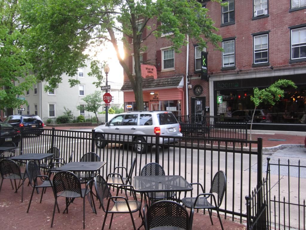
Halting demolition efforts on some abandoned and derelict buildings for historical purposes... Good idea?
I found this article in today's Tribune Review website visit. We have all seen abandoned houses or other structures and often thought, "when is someone going to take a wrecking ball to this thing?" Apparently one reason for delaying demolition is a investigation/assessment to determine if there is any historical significance to the structure. If there is, would it be feasible to rehabilitate this structure for some future use?
Is this a good idea?
While some structures may have historical significance, rehabbing them probably is not entirely in the best interest for adjacent residents or businesses, passers-by, or the neighborhood in general. If it would be less costly to just wreck it and either build a new structure or incorporate some public space in its place, then so be it. In many cases, derelict buildings are a huge liability. They can literally be falling apart, can be the focus of less than reputable activity, or just deter people or businesses from either relocating or expanding in the neighborhood.
I am all in favor of preserving as much of our history, but for some buildings it is probably better to tear down and rebuild. If it is in a historically significant neighborhood, then new construction could likely incorporate some architectural characteristics into its future buildings...
For the story (Aaron Aupperlee, 5/29/2013) from the Pittsburgh Tribune-Review website, here is the link:
Residents ask Pittsburgh to halt demolition of vacant homes
Tuesday, May 28, 2013
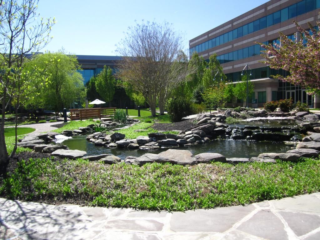
My vision for Baldwin Borough, Pennsylvania

Above is my vision for Baldwin Borough, which is one of several municipalities surrounding the City of Pittsburgh. This municipality of roughly 18,000 residents is immediately to the south of the city. Pennsylvania Highway 51, labeled here as Clairton Blvd, leads directly into the city after traversing Whitehall and Brentwood. As mentioned in the previous post, some municipal and business leaders are actively discussing possible ways of improving the Route 51 corridor between Pittsburgh and the southern suburbs through which it passes. Brentwood and Whitehall Borough are strongly in favor of a redevelopment. Baldwin, on the other hand, is firmly against; citing the relatively short distance it travels while in the narrow borough.
Members of borough council suggest not spending any money to improve the road, indicating that doing so would be a waste of time considering the reason stated above. I, however, think improvements should be pursued regardless. It does not matter if the road travels through a half-mile or ten or twelve miles. It is still within the municipality, and improving the corridor can go a long way in promoting business and economic growth.
Indicated in the above image, courtesy of Google Earth, are several aspects to this vision in addition to the improvement to Route 51. My vision for the borough includes the following:
- Establishments of central business districts to grow and develop a commercial tax base for the municipality
- Establishment of a commuter rail link between Pittsburgh and Washington using existing lightly-used CSX line. Streets Run Road, linking Baldwin with the Hays neighborhood of Pittsburgh, experiences considerable congestion at morning and evening rush times.
- Two station locations along the possible commuter rail line to provide direct access to each business district
Leland Pointe Apartments, formerly known as Green Meadows, was recently renovated to improve the living conditions for the residents. Prior to the renovation, numerous ideas, including a golf course, were floated around according to a neighborhood newspaper. My vision ultimately would call for a complete overhaul of this complex and the neighboring strip mall through which the Jefferson Hills Borough border passes. It includes a redesign of the street grid to have more of a "main street" layout and to incorporate numerous mixed use buildings.
Sunday, May 26, 2013
Redesigning Saw Mill Run Boulevard, a major gateway between Pittsburgh and the South Hills.
Currently, Saw Mill Run Boulevard, which carries the designation of Pennsylvania State Highway 51, is a busy thoroughfare built in the 1920s. The four-lane highway is not only plagued with congestion in many parts, but the corridor itself is lined with a series of derelict structures, many of which have sat vacant for over a decade. Ownership of those pieces of property have prevented any revitalization or roadway enhancement project from moving forward.
As of a few years ago, some business leaders and municipal workers from Baldwin, Brentwood, Whitehall, as well as the City of Pittsburgh have collaborated to develop a master plan to rebuild Saw Mill Run Boulevard (Clairton Road south of Brownsville Road in Brentwood). This collaboration, called Economic Development South, plans to turn this corridor into a landscaped boulevard attractive to business development as well as pedestrians, bicyclists, and transit users. Their vision for this stretch of Route 51 includes:
As of a few years ago, some business leaders and municipal workers from Baldwin, Brentwood, Whitehall, as well as the City of Pittsburgh have collaborated to develop a master plan to rebuild Saw Mill Run Boulevard (Clairton Road south of Brownsville Road in Brentwood). This collaboration, called Economic Development South, plans to turn this corridor into a landscaped boulevard attractive to business development as well as pedestrians, bicyclists, and transit users. Their vision for this stretch of Route 51 includes:
- Rebuilt four-lane roadway with either landscaped median or tree-lined curbs to calm the speeds of vehicular traffic.
- Redevelopment of the existing buildings to allow for best use of the land and to promote business and economic development
- Improved transit access (i.e. transit shelters, wider sidewalks) to encourage recreational activity and promote a safe environment for bicyclists and pedestrians.
Thursday, May 23, 2013
Bill Peduto won the Democratic nomination for Mayor of Pittsburgh
Tuesday, Pittsburgh elected Bill Peduto as the Democratic nominee for Mayor, and he stands a solid chance to win the election for Mayor in November considering the previous Mayoral elections. Already, Peduto is making an attempt to overhaul City Hall with a "top-to-bottom" cleansing. The story on this can be found at http://triblive.com/news/adminpage/4052722-74/peduto-mayor-chief#axzz2U9sTtXAH.
Monday, May 20, 2013
Pittsburgh's next mayor; Bill Peduto vs Jack Wagner
Tomorrow, Pittsburgh will vote on a new choice for Mayor given the current mayor's decision to resign and not run for a second term. Among the group of Democrats running for the vacancy are Mr. William Peduto, a member of City Council representing Squirrel Hill and other parts of the east end, and Jack Wagner, who announced his campaign shortly after Mayor Luke Ravenstahl announced his decision to not pursue another term.
Bob O'Connor, who was elected as Mayor in November, 2005, succumbed to Cancer just over six months into his term. Much of the development that took place between 2006 and 2012 was spearheaded by Mr. O'Connor. I recall one press article regarding the on-going attempts to revitalize Downtown's Fifth-and-Forbes corridor; Mr. O'Connor wanted the proposals to have a "wow!" factor. Projects that started under his administration included Piatt Place, which was a reconfiguration of the abandoned Macy's Department Store at Fifth Ave. and Wood St., and Three PNC Place. These projects, however, did not come to fruition until some time during Luke Ravenstahl's administration, which took over after O'Connor's passing.
O'Connor was, in my opinion, a rather passionate political leader who seemed in touch with the citizens. In his earlier days of his short time in office, he did go out and visit a variety of neighborhoods and listened to input of what they would like to see from the Mayor. However, he was not my prime choice for the position. My prime choice then was the same choice for the current election.
Bill Peduto had been serving as a councilman for several years and always had the best interests for both city and citizens at heart. Some of his ideas included many urban renewal projects and consolidating part of Allegheny County with the city of Pittsburgh to reduce the fragmentation among local governments. Even though he did not win the Mayoral election, he remained very active on City Council and was a driving force in the redevelopment of East Liberty. Many of his ideas were outside-the-box; not typical for Pittsburgh, and it is that kind of thinking that will springboard the city and region into the future.
Mr. Wagner, on the other hand, seems more comparable to the city's current Mayor. Mr. Ravenstahl, in spite of his young age, actually has firmer ties to older-school politics; those who labor under the delusion that Pittsburgh is stuck in the past. They try to employ some of the older policies that really do not apply to the city moving forward. Ravenstahl and the Allegheny Conference on Community Development (ACCD) and at times the Urban Redevelopment Authority seemed to be at constant odds. The ACCD had a few visions that Ravenstahl emphatically objected to. To be honest, I'm not even sure what Mr. Ravenstahl's vision was exactly. Is it any wonder why the County Executive, Rick Fitzgerald, is often on the same wavelength as Mr. Peduto? Again, in a nutshell, Peduto is the best choice for Pittsburgh moving forward...
(Disclaimer: I am not at all affiliated with Mr. Peduto or his campaign in any way. I was born and raised in Pittsburgh and have a strong interest in its future. This is entirely my opinion even though I no longer reside within the region.)
Thursday, May 16, 2013
Rethinking our Urban Freeways; Improving the urban cores of Philadelphia and Pittsburgh
Yesterday afternoon, I attended an online webinar courtesy of the American Planning Association, and the topic was freeways that cut right into or through our urban cores or central business districts. The webinar covered some examples of how some cities have either removed or plan to remove and urban freeway and replace it with a surface boulevard or other public space.
After listening to the information, I began thinking of how each example could be applied to the problem highways in Pennsylvania's primary urban centers. The Vine Street Expressway and Interstate 95 isolate Center City Philadelphia from other surrounding neighborhoods, with the latter cutting off access to the Delaware River. In Pittsburgh, the Crosstown Boulevard isolates the Lower Hill neighborhood from the Central Business District. Interstate 279, also in Pittsburgh, separates the Central North Shore neighborhood from the parcels of land adjacent to the Allegheny River.
The Vine Street Expressway and Interstate 95
Both highways are already located below grade. Fixing both, therefore, would not require too much work. Construction of a "green cap" over I-95 has already been heavily discussed, and there are some loose proposals for one in the vicinity of Penn's Landing. In fact, I-95 does have a partial green cap in some areas,providing landscaped greenery for recreational use. The city is also discussing the possibility of reworking Columbus Boulevard, which runs parallel to I-95. A reconstructed Columbus Blvd. would incorporate the existing rail line into a light rail system as well as improved bike and pedestrian access. Capping I-95 would only enhance this project even more.
The Vine Street Expressway is entirely below-grade with the surface street grid left in tact due to several overpasses. A series of green caps here would create an immense mile-long green recreational space reconnecting the central business district with Lower North Philadelphia.
The Crosstown and Interstate 279
In Pittsburgh, one highway is below grade and the other is elevated. The Crosstown, which is below grade and separates the Lower Hill neighborhood from Downtown, would need a cap only in one or two locations. There is a conceptual design for the former Mellon Arena site that already calls for such a cap. Representatives of the Lower Hill neighborhood favor a cap because it would provide a sense of connectivity between the Lower Hill and the central business district, which was lost during the 1950s when the boulevard was built to improve through-traffic flow. The highway was later modified with the completion of the Veterans Bridge which spans the Allegheny River. With this bridge, motorists can essentially bypass Downtown entirely and travel between the North Hills and South Hills neighborhoods and suburbs.
Interstate 279, or the Parkway North as it is sometimes referred to, was completed around the same time as the aforementioned Veterans Bridge. While the Crosstown provides a bypass to the east, I-279 provides a loop around the north of Downtown and is an elevated structure. A complete overhaul of this road would require demolition work and a series of detours as well as excavation to rebuild the highway below-grade. Regardless, the end result would be a drastically improved urban landscape for the Central Northside neighborhood.
What rethinking each road would mean for the overall livability of their respective urban cores
Whether we're discussing improving connectivity between Philadelphia and the Delaware River or Downtown Pittsburgh with its Lower Hill neighborhood, reworking the highways that divide both will go a long way in improving the overall livability of each city. Philadelphia is attempting to improve its bike and walk-ability by establishing bike lanes and improving its sidewalks. Pittsburgh is trying to reconnect with its rivers. Aside from improved bike and pedestrian access, rethinking the highways in these cities will:
- Improve and enhance recreational space and encourage recreational activities such as sightseeing and people-watching, as well as walking, jogging, and biking.
- Link once isolated sections of the urban core with each other, improving the chances of reinvestment and redevelopment, providing a sense of identity and purpose for the once isolated neighborhoods (i.e. the Delaware Waterfront, Lower Hill).
- Boost property values of the pieces of land that were once cut off from the urban core, which also will likely increase demand for development or redevelopment.
Open-ended question: What if these urban freeways were to be removed entirely and replaced with surface boulevards?
The above information I posted is based on my opinion and vision for rethinking the highways in/near central Philadelphia and Pittsburgh. In the online seminar, the examples discussed a complete removal of a highway with a surface boulevard serving as the replacement. Here is where I would like some feedback. What would be the benefits or consequences of, say, completely removing the Vine Street Expressway or I-95 in favor of a vastly improved surface Vine Street or Columbus Boulevard respectively? I-95 would likely have to be realigned. I'm thinking renumbering the Blue Route and I-276 as I-95 as one suggestion for such. Still, any feedback is welcome.
Tuesday, May 14, 2013
Could Regional Rail Extension Boost Redevelopment Efforts in West Chester?
Gay Street was not the only place my wife and I strolled along while in West Chester. We also walked along portions of Market Street. High Street, which is the main street running north and south, essentially splits the borough right in half. West Market Street sees more in the way of pedestrian activity with numerous offices and a few restaurants and shops. Walking down East Market Street, however, we saw fewer restaurants and shops, especially beyond Walnut Street, which is the next north-south street over from High.
Gay Street, both East and West, experiences a great deal of pedestrian activity as there are a plethora of restaurants, bars, and shops as well as businesses along this street. Market Street sees such activity primarily along West Market while East Market is all but devoid of pedestrian activity. I have a theory as to why this may be, and I think it has to do with the rail line that once provided SEPTA regional rail service to Media-Elwyn and Philadelphia. SEPTA discontinued regional rail service in September, 1986, due to deplorable track conditions. Instead, they decided to upgrade facilities along the Pennsylvania Main Line, along which SEPTA operates the Paoli-Thorndale line.
The Borough of West Chester and West Chester University are just a couple of the various groups who emphatically want regional rail service restored. In 2010, I completed a research project on this matter while pursuing my masters in geography from West Chester. I concluded that the area along the line has seen a significant amount of population growth that should support such service. In addition to the population data, I also observed traffic and land use patterns and found strong similarities between the abandoned portion of the Media-Elwyn line and the active Paoli-Thorndale line.
Aside from this line providing direct access to Philadelphia and other points in between, I also believe that such transportation access could bolster demand in the struggling eastern part of the Market Street corridor. In fact, I noticed a sizable mixed-use project that apparently has been stalled for several years. It calls for ground-level retail space with residential uses occupying the upper three or four levels, and its location is only a block away from the abandoned rail line. In addition to this project, there are underutilized parcels of land within immediate proximity of the rail line. So here is the question. Could a reinstatement of regional rail service restart the aforementioned stalled project and encourage development of other adjacent underutilized parcels into more of a transit-oriented community?

Above is the decaying stalled project that was intended to be a mixed-use development. Apparently, the only completion so far has been the partial demolition of an existing dilapidated structure. It should also be noted that this part of town was likely an industrial section given the location of the rail line. Below is the more commercial western corridor of Market Street. Office buildings are clearly visible, and in the distance is the Chester County Courthouse. Behind me is High Street, and most of the restaurants are within the block between High and Church Streets.

I suppose there could be a follow-up question. If it has not done so already, would it be beneficial if the borough implemented a change to its zoning or land use ordinance to encourage more commercial development in the area along West Market Street?
Monday, May 13, 2013
Up-close and Personal with West Chester, PA
Last week, my wife and I went to a restaurant in West Chester Borough, the county seat of Chester County, where we attended a marketing event related to my current job. Following that event, we took a walk around the borough and observed the scenery.
Over roughly the last 20 years or so, the borough has experienced a period of urban renewal. Gay Street has become a hot bed for retail and restaurant use, boosting pedestrian activity. Improvements to the streetscape such as wider sidewalks to accommodate sidewalk cafes and pedestrians, light posts, and flower boxes all boosted the pedestrian activity.
This street has quite often been used as a guinea pig in my urban planning classes I took at West Chester University when discussing urban renewal and downtown revitalization. In my planning design class, we took a field trip to this street and pointed out the aspects used in this urban renewal project. We acknowledged various design aspects like uniform setbacks, the historical architecture preserving the character of this historic borough, the tree-lined streets, landscaping, unidirectional traffic flow to name a few and how each of those combined to make for a very efficient public pedestrian-friendly place.
Here is our walk down Gay Street in West Chester Borough.
Wednesday, May 8, 2013
Bringing SEPTA Rail Service to King of Prussia
According to PlanPhilly, The Southeastern Pennsylvania Transit Authority (SEPTA) is studying a potential extension of the Norristown High Speed line to King of Prussia, a burgeoning suburb in Montgomery County roughly 30 miles from Center City Philadelphia. This is also a location that is regularly plagued by congestion with several major roads, including the Pennsylvania Turnpike, Schuylkill Expressway, US 202, and US 422, all converging in this area.
While the High Speed Line may lead to more options for commuters traveling between Philadelphia and King of Prussia, this could potentially change the urban landscape. With several stops serving the Mall at King of Prussia along with several other major employment, retail, and residential centers, parking design and layout could be influenced. Currently, surface parking lots seem to encircle many of these centers. As a result of station access, could we see structured parking structures along with transit-oriented development dotting the landscape in this corridor?
Read the full article at the PlanPhilly website at http://planphilly.com/articles/2013/05/08/king-of-prussia-transportation-website-aims-to-reduce-congestion
Sunday, May 5, 2013
An Up-Close Look at Valley Creek Corporate Center
This is a closer look at a fairly well-designed corporate business park about an hour outside of Philadelphia. Included in this post is a series of photos taken today. This corporate park was clearly to be considerably larger. In one of the photos, construction/structural equipment for a later phase is visible off in the distance. Apparently demand tapered off, and the recent economic downturn only further hampered any chance of seeing this come to fruition. Here is a series of photos my wife and I took after a long walk along the Chester Valley Trail. The fellow in figure 3 wearing a dark shirt, khaki pants and tan hat is none other than yours truly.
 Depicted above is the central recreational space in between the three buildings of Valley Creek Corporate Center. In addition to the landscaped greenery, the courtyard also contains a water feature as well as a seating area which is visible off in the distance.
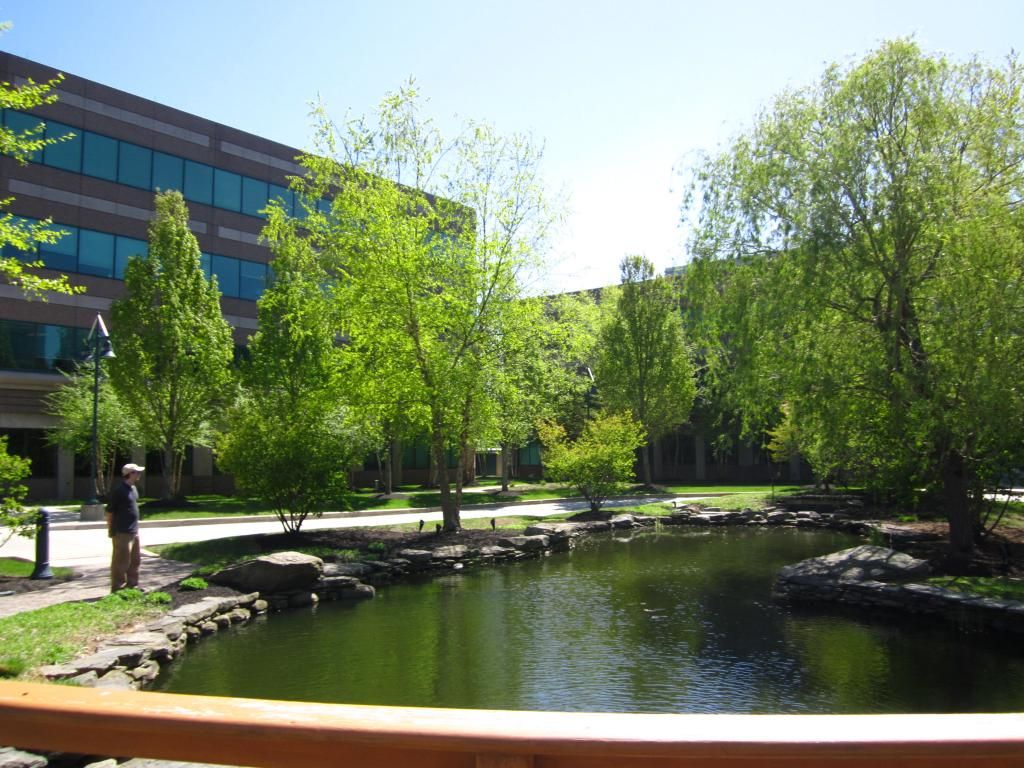

In Figure 2 is the waterfall and stream component of the water feature.
The stream eventually leads to the expansive goldfish pond. Viewpoint is caught from a pedestrian bridge leading over the stream. The photos above and below give an impression of an "outdoor room," as defined in Ewing and Bartholomew's "Pedestrian & Transit-Oriented Design" (2013) as any open land containing buildings and/or trees as walls and the sky providing the "ceiling."
The bottom two pictures illustrate the adjacent Chester Valley Trail. The top picture is looking toward the west, and one of the buildings at the corporate center is visible in the background. In the eastbound-looking image at the bottom, you can see construction equipment off in the distance. Also visible is a walker enjoying a stroll along the trail. Notice how the fencing in the median helps to enhance pedestrian safety at this street-level pedestrian crossing.
This trail currently ends at the Wegman's shopping center in Malvern, which is supposed to be part of a larger TND development containing office and residential use in addition to the existing retail establishments. Adjacent to this development is the corporate campus of Vanguard Group, through which this trail passes (or will pass once the entire Upland at Worthington development is completed).
Friday, May 3, 2013
Chevron and US. Steel; A Continuation of the Vertical vs. Horizontal Development Debate.
In my most recent post, I introduced the idea of improving both the urban core high-rise as well as the more suburban low-rise sprawling office complex. Over the last few days, the local press out of Pittsburgh has confirmed that US Steel will remain close to Downtown Pittsburgh should they move out of US Steel Tower, and Chevron is completing their acquisition of 61 acres of land in Robinson Township, near the Pittsburgh International Airport.
While both will be considered huge wins for the greater Pittsburgh area (a net-gain of one regional headquarters for a major corporation while maintaining and expanding the global headquarters of another one), both will likely exhibit two different types of development. Chevron will likely have a sprawling complex, but US Steel has informed the press that they are interested in remaining downtown.
How Chevron could develop more of a bike/pedestrian-friendly, less auto centric development
Considering that the Montour Trail is almost directly adjacent to the likely future site of Chevron's regional headquarters, their layout should incorporate some bicycle and pedestrian-friendly infrastructure. Considering this location is adjacent to an interchange with I-376, providing direct access to the airport, Downtown Pittsburgh, and other areas of particular interest north and south of the city, heavy origin and destination auto traffic will heavily influence this development. The following is a list of best use practices Chevron can incorporate into their new regional headquarters:
As stated in the previous post, Class A office buildings usually do not favor public use. While some do have plazas adjacent to them, they are not the type that the general public can access and use freely. While it is still uncertain whether they will consider one tall structure or a campus of medium-rise buildings (15-to-25 story range), this development will likely be something very dense. Given the surge in Downtown's population with the latest residential developments, Downtown developments should promote and encourage public use. Whether US Steel considers a single building or a group of buildings, they should consider at least two of the following:
While both will be considered huge wins for the greater Pittsburgh area (a net-gain of one regional headquarters for a major corporation while maintaining and expanding the global headquarters of another one), both will likely exhibit two different types of development. Chevron will likely have a sprawling complex, but US Steel has informed the press that they are interested in remaining downtown.
How Chevron could develop more of a bike/pedestrian-friendly, less auto centric development
Considering that the Montour Trail is almost directly adjacent to the likely future site of Chevron's regional headquarters, their layout should incorporate some bicycle and pedestrian-friendly infrastructure. Considering this location is adjacent to an interchange with I-376, providing direct access to the airport, Downtown Pittsburgh, and other areas of particular interest north and south of the city, heavy origin and destination auto traffic will heavily influence this development. The following is a list of best use practices Chevron can incorporate into their new regional headquarters:
- Construct bike/pedestrian trail parallel to the main entrance. Consider the placement of bike storage racks near the main entrances of each building. With a bike and pedestrian-friendly design, Chevron could encourage their employees to either walk or ride to work.
- Incorporate a parking structure to minimize surface parking. Any saved space should be considered for either open space or recreational use.
As stated in the previous post, Class A office buildings usually do not favor public use. While some do have plazas adjacent to them, they are not the type that the general public can access and use freely. While it is still uncertain whether they will consider one tall structure or a campus of medium-rise buildings (15-to-25 story range), this development will likely be something very dense. Given the surge in Downtown's population with the latest residential developments, Downtown developments should promote and encourage public use. Whether US Steel considers a single building or a group of buildings, they should consider at least two of the following:
- a lobby that is very accessible to the general public.
- a pedestrian friendly streetscape.
- Ground-level restaurants or retail
- Public artwork in the lobby or lobbies of buildings)
- An open plaza to enhance green space in the city
- Liberty Place (Philadelphia): office tower complex contains numerous restaurant and retail uses in an adjacent complex. Plus, there is a Westin Hotel within the complex.
- Comcast Center (Philadelphia): Philadelphia's tallest building contains a pedestrian-friendly out-door plaza with fountain as well as a large television screen in the lobby to entice the public
- One Oxford Center and Fifth Avenue Place (Pittsburgh): office towers contain a retail complex within each building.
- PPG Place (Pittsburgh): tower complex contains an outdoor plaza with a fountain in the warmer months and an ice rink in the winter. One PPG Place, the complex's signature 40-story glass tower, contains an indoor winter garden where a proposed high-end restaurant will likely be located.
- Former FORE Systems headquarters (Pittsburgh, North Hills): Although the development is auto centric, the complex does incorporate a large central green space into its design.
- Parkway Center complex (Pittsburgh, western suburbs): complex exhibits structured parking as well as some recreational green space.
- Valley Creek Corporate Center (Philadelphia western suburbs): Currently comprised of three buildings partially enclosing and outdoor recreational space, provides direct access to a hiking and biking trail
Subscribe to:
Posts (Atom)